City Maps
Interactive Map
Our Interactive map will allow you to search, view, measure and print maps and database information. This map allows you to retrieve City of Wentzville information and creates associated maps on the fly. This site displays various map layers that overlap each other, such as zoning districts, parcels, school district boundaries, traffic counts, the solid waste collection schedule and more.
Interactive Map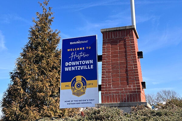
Interactive History Map
This interactive story map highlights various locations of particular historical value. This map can be viewed on a computer or, for the urban explorer, it features an integrated mobile interface for a web-enabled tablet or smartphone.
Interactive History MapDownloadable Maps
Agricultural Soil Types
The Agricultural Soil Types Map displays information on soil types in the Wentzville area as it relates to agricultural activities.
Ambulance District
The Ambulance District Map displays the area of Ambulance District Three covering the entire Wentzville City area and the adjacent District Four.
City and County Parks
The Parks Map depicts the location of both developed and undeveloped park properties owned by the City of Wentzville and/or St. Charles County in relation to the major roadway networks of the area.
City of Wentzville Bicycle and Pedestrian Facilities Plan
The Trails and Greenways Map depicts planned trails and their linkages throughout St. Charles County. Individual communities have independent trail master plans which depict greater detail for local trail corridors and linkages.
The Land Use Plan depicts, by color shading, the various types of land use anticipated by the City throughout the City’s growth boundary. The map serves as a major policy document guiding zoning decisions and use of property.
Corporate Limits Map
The Corporate Limits Map depicts by color shading all of the property, which is a part of and incorporated into, the City of Wentzville, Missouri.
Corridor Preservation Map
The Corridor Preservation Map displays two planned roadways in which the City has formal documents, which details the location of right-of-way required for reservation or dedication as new development occurs which may impact the corridor.
Downtown Parking Map
Visiting Historic Downtown Wentzville for an event, a bite to eat or some shopping? Plenty of free, public parking is available! This new parking map indicates both on-street and off-street parking. Come explore Historic Downtown Wentzville!
Drainage Areas
The Wentzville Drainage Area Map displays the various watersheds in the Wentzville City area. Two major watersheds (Big Creek Basin and Peruque Creek Basin) make up the Wentzville City area.
Electric Service Area
The Electric Service Map displays the service areas of Ameren UE and Cuivre River Electric Cooperative who are the two major power suppliers in St. Charles County.
Existing Land Use
The Existing Land Use Map displays all properties in the City’s planning area via colored coding to indicate the type of existing land use.
Fire Protection Districts
The Fire District Map indicates the locations of fire stations and shows the boundaries of various Fire Districts in western St. Charles County. Wentzville City is located within the Wentzville Fire Protection District.
High Pressure Pipelines
The High Pressure Pipelines Map indicates the approximation location of High Pressure Utility Pipelines in western Saint Charles County. The Wentzville Subdivisions that lie adjacent to these pipelines are also indicated in this map.
Major Soils Group Map
The Major Soils Group map indicates the dominant soil types in the greater Wentzville area.
Natural Resources Map
The Natural Resources Map displays areas of existing tree canopy, dominant soil types of the area, streams and creeks and their associated floodplain areas and water features within Wentzville City and the growth area.
Natural Watercourse/Riparian Buffer Protection Map
The Riparian Buffer Protection Map displays waterways in which a setback distance is enforced for the protection and stormwater quality of the City’s creeks and waterways.
New Subdivisions Map
The New Neighborhoods Map depicts active and completed subdivision projects in the community code/number designation with the title of the project depicted in the legend.
Planning Area Location Map
The Location Map offers the reader a look at the position of the City of Wentzville within St. Charles County, also providing a map window of the location of St. Charles County within the State of Missouri and Missouri within the United States.
Special Taxing Districts
The Special Use Districts Map displays the independent taxing districts which exist in the City of Wentzville related to Neighborhood Improvement Districts, Community Improvement Districts, Transportation Development Districts and their associated sales tax.
St. Charles County School Districts
The School District Map depicts the location/boundary of Wentzville R-IV School District related to other established school districts in St. Charles County.
Stormwater System
The Storm Drain Map depicts the locations of Inlets, Stormwater lines and Outfalls for the Wentzville Stormwater Utility.
Street Construction Standards
The Street Construction standards drawing provides the required specifications for new roads for the City of Wentzville.
Street Index Map
The Street Map provides the user a depiction of all streets in the community down to the local level and includes private streets in the City area.
Thoroughfare Plan
The Thoroughfare Plan depicts the existing roadways in the community planned for improvement and their functional classification and also depicts planned new roadways in the community. The Plan serves as a major policy document guiding right-of-way dedications via the development approval process.
Trails and Greenways Development Plan
The Trails and Greenways Development Plan map shows the location of existing & proposed hiking trails and bicycle lanes throughout Saint Charles County.
Ward Boundary Map
The Ward Boundary Map displays the areas of the City by ward, which are color coded, providing a ward boundary line and number designation.
Water Service Boundary
The Water Service Boundary Map displays the service area and boundary line for Water District #2 and the area which is served by the City of Wentzville Municipal water system.
Wentzville Flood Zones
The Flood Zone Map depicts the major creeks and waterways in the City of Wentzville, which are identified upon the National Flood Insurance Programs mapping, where special development regulations and restrictions apply to all new construction or grading.
Zoning Map
The Zoning Map depicts the various zoning classifications in the City which have been adopted by Ordinance. Contact the City Planning Division or City Clerk’s Office for official records related to this mapping document.
Content contained within these maps may use services provided by Texas A&M Geoservices.