David Hoekel Parkway Phase 2D
David Hoekel Parkway Phase 2D will be a north-south roadway of approximately 5,500 linear feet along an existing 100-foot wide City of Wentzville right-of-way corridor. Once completed, this roadway will help alleviate congestion and convey motorists to and from Interstate 70 to West Meyer Road. This project will complete the final segment of David Hoekel Parkway Phase 2.
Drone Tour
Watch this video to see a complete, updated tour of the route.
CLICK THE THUMBNAIL TO VIEW THE FULL-SIZE RENDERING.
 |
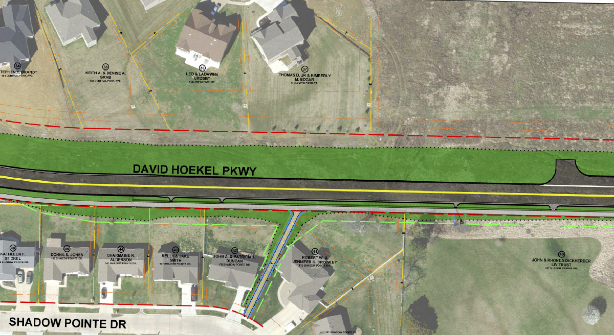 |
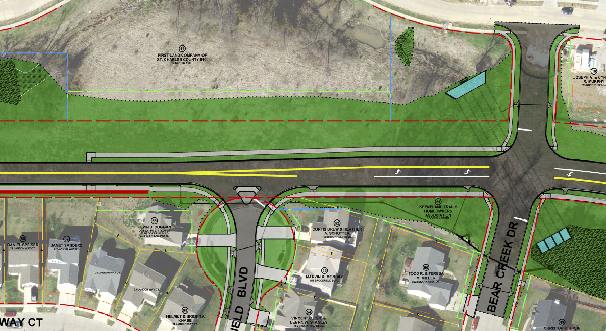
Phase 2D of David Hoekel Parkway (DHP) includes roadway improvements along the planned DHP corridor between Goodfellow Road and West Meyer Road. This phase of the project will build upon previous phases of DHP by connecting West Meyer Road to the I-70 interchange at DHP and to the south side of the interstate. The proposed project will construct two lanes of DHP on the eastern side of the corridor, one northbound lane and one southbound lane. The ultimate DHP build-out will consist of a four-lane divided roadway. The timeline for the final corridor buildout is currently undetermined and will be based on future traffic demands. The current phase of this project also includes a sidewalk, which will connect pedestrians to the trail that was recently constructed with the West Meyer Road improvements and to the sidewalk being constructed with the David Hoekel Parkway bridge over I-70.

When available, please see the underlined dates for additional project details.
When available, please see the underlined dates for additional project details.
2024:
Roadway Construction
2023:
Grading and Construction of Drainage Facilities
2022:
Easement & Right of Way Acquisition
2020-2021:
The City entered into a funding agreement with St. Charles County for the final design and construction of Phase 2D of David Hoekel Parkway. The City retained the services of a design firm to prepare plans and specifications for this project. The noise study has been re-evaluated with the preparation of plans for construction.
2018:
The City retained the services of a design firm to evaluate this David Hoekel Parkway Phase 2D corridor and provide the City with conceptual plans, cost estimates, traffic circulation reports and a sound wall analysis. During this Phase 2D corridor evaluation, the City evaluated whether the previously recommended four-lane median-divided configuration identified within the David Hoekel Parkway Environmental Assessment that was completed in November of 2014 was still valid for initial construction or if a reduced two-lane cross-section might instead be adequate to serve the anticipated future traffic volumes. The report confirmed that David Hoekel Parkway Phase 2D’s ultimate cross-section shall provide a four-lane median divided cross-section as previously recommended by the David Hoekel Parkway Environmental Assessment but current and near-future traffic volumes only require a two-lane cross-section to be built at this time. As a continuation of the current David Hoekel Parkway Phase 2C project (Interstate 70 north to Goodfellow Road), the traffic circulation report also confirmed that building the eastern half of the ultimate roadway cross-section (the northbound lanes) with northbound and southbound left-turn lanes at both Bear Creek Drive and Kruger Park Court intersections was recommended until traffic volumes require the additional two lanes (the southbound lanes) to be constructed.
2014:
The U.S. Department of Transportation (Federal Highway Administration) approved the City’s proposal to design and construct a new interchange along the I-70 corridor as part of the David Hoekel Parkway designated as Phase 2A, B, & C. The interchange project is expected to be completed Summer of 2021. Phase 2A, B, & C included the interchange at Interstate 70 and a realigned North Outer Road as well as the intersection of David Hoekel Parkway and Goodfellow Road/North Outer Road. The David Hoekel Parkway Phase 2D project will begin at this intersection and proceed north to tie in with West Meyer Road.
2009-2014:
The City submitted a draft Environmental Assessment to the U.S. Department of Transportation Federal Highway Administration (FHWA). This document considered and evaluated project alternates and environmental consequences for impacts to land use, water quality, cultural resources, threatened and endangered species, air quality, noise and construction impacts among other factors. The FHWA issued approval of the Environmental Assessment and issued a Finding of No Significant Impact.
2003:
The Corridor Preservation Study allowed the City to coordinate with proposed and planned development to preserve the Right of Way.
2001:
The City studied a corridor (several alignments) and involved the public for comment which identified this corridor called the "I-70/US 61 Beltway Corridor Preservation Study."
1999:
The City first adopted a Comprehensive Plan identifying the need for a new roadway.
For questions regarding this project please contact Tony Gambaro, Engineering Manager, at Tony.Gambaro@wentzvillemo.gov


